
Climate Maps
Temperature, precipitation, and snowfall maps are created via the Applied Climate Information System (ACIS) with data collected from weather stations and Community Collaborative Rain, Hail, and Snow (CoCoRaHS) observations. Climate maps are courtesy of the Northeast Regional Climate Center; all data is updated weekly or on the third day of each month. Products that reference “normal” are based on 1991-2020 climate normals.
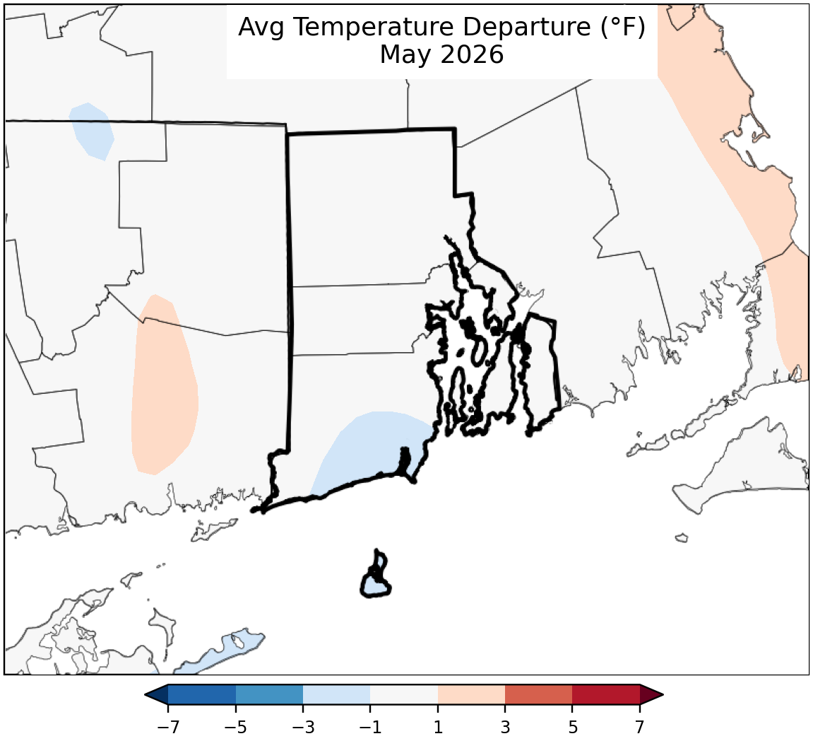
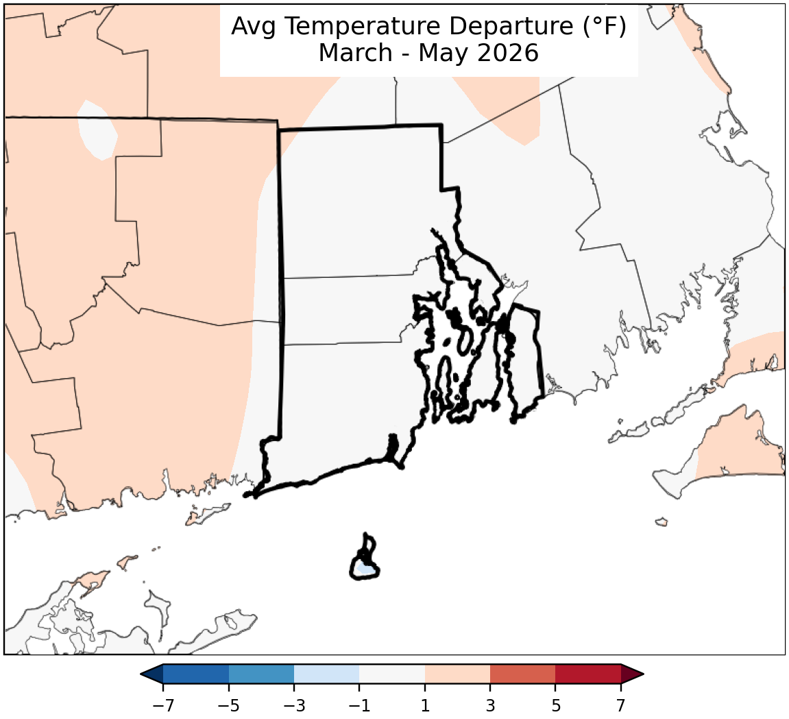
Temperature Maps
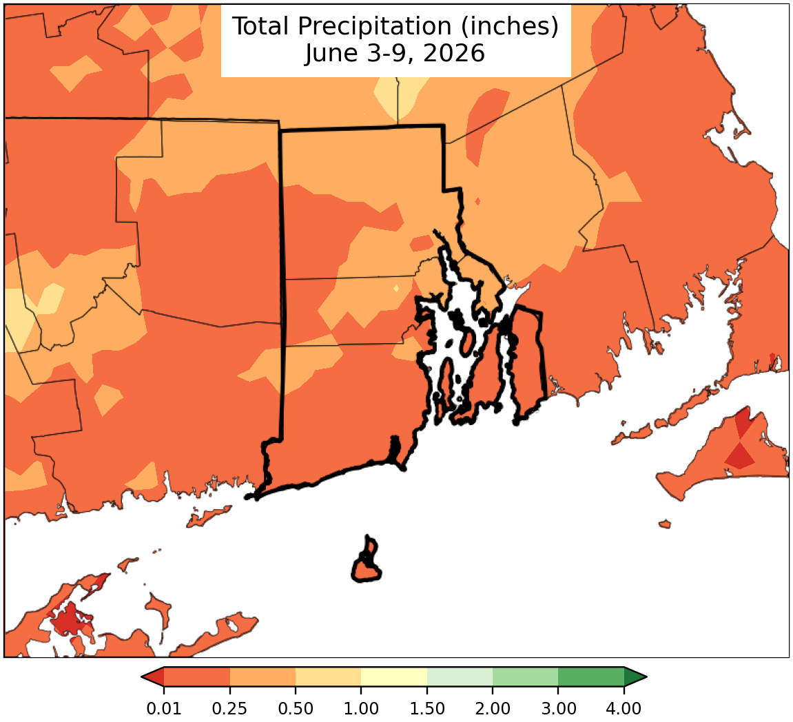
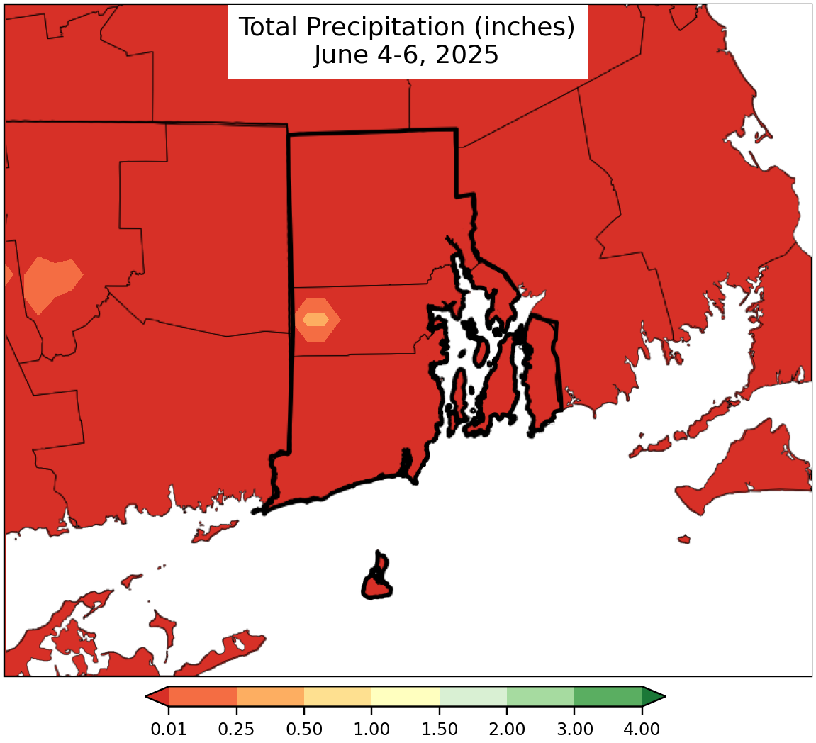
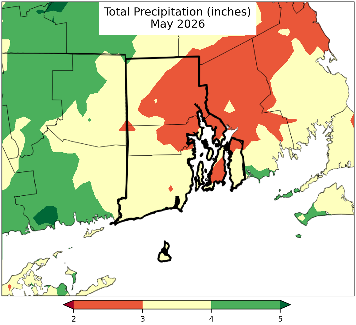
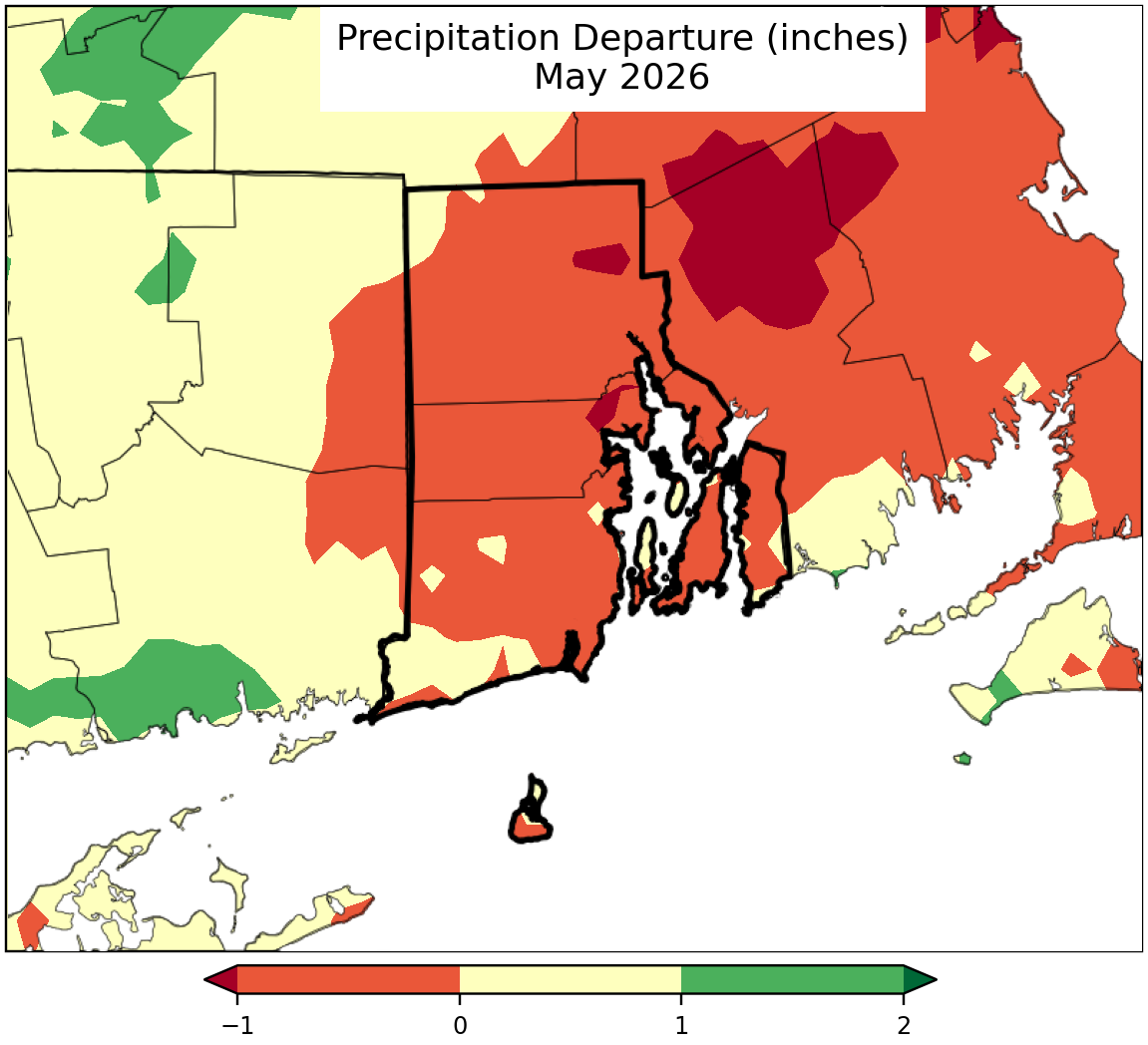
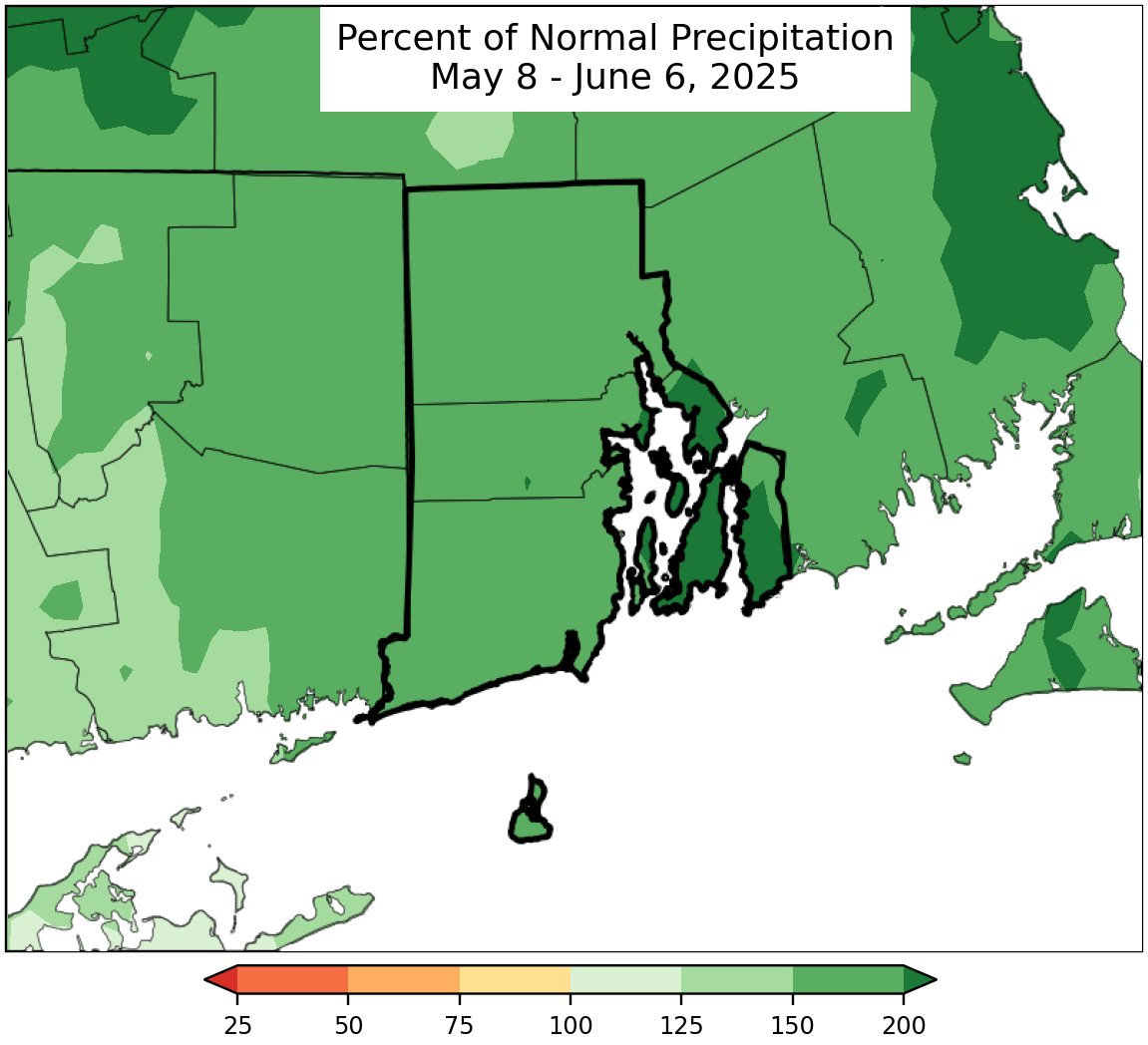
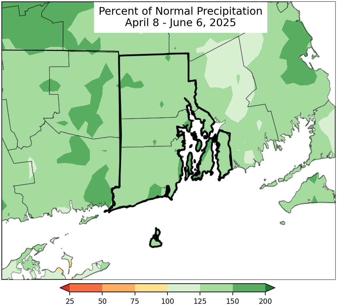
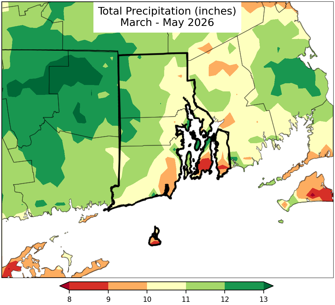
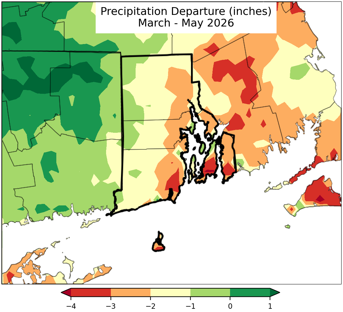
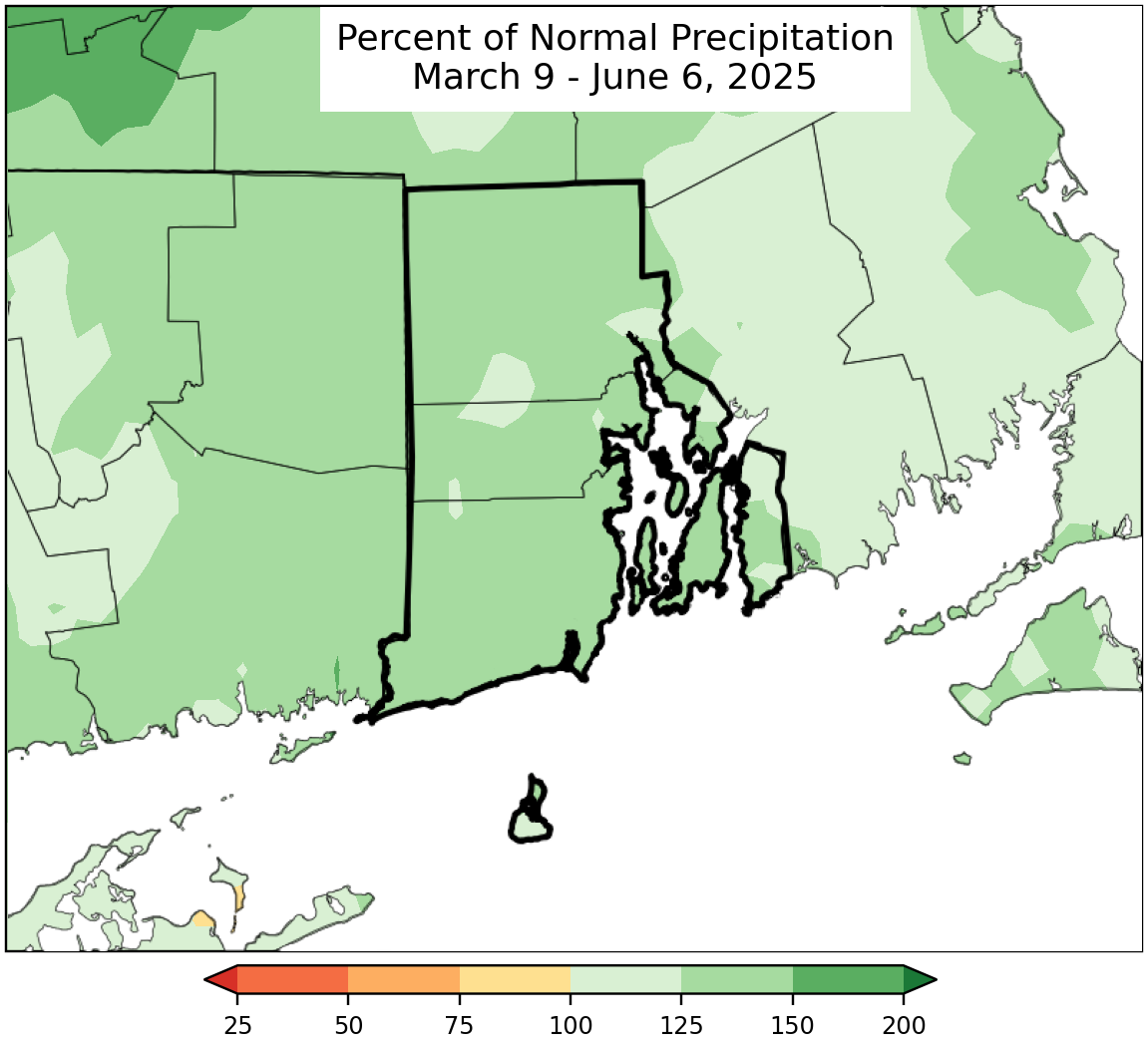
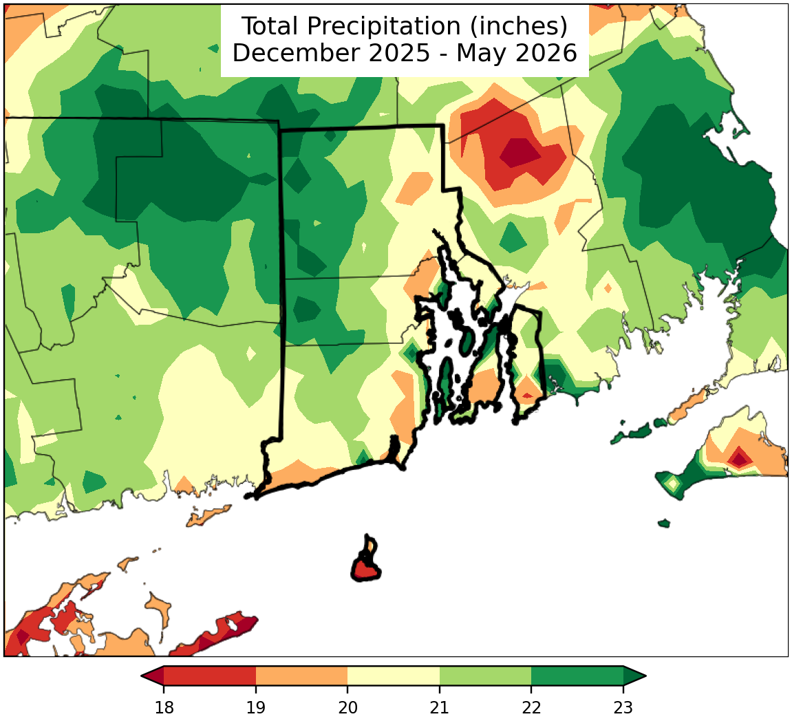
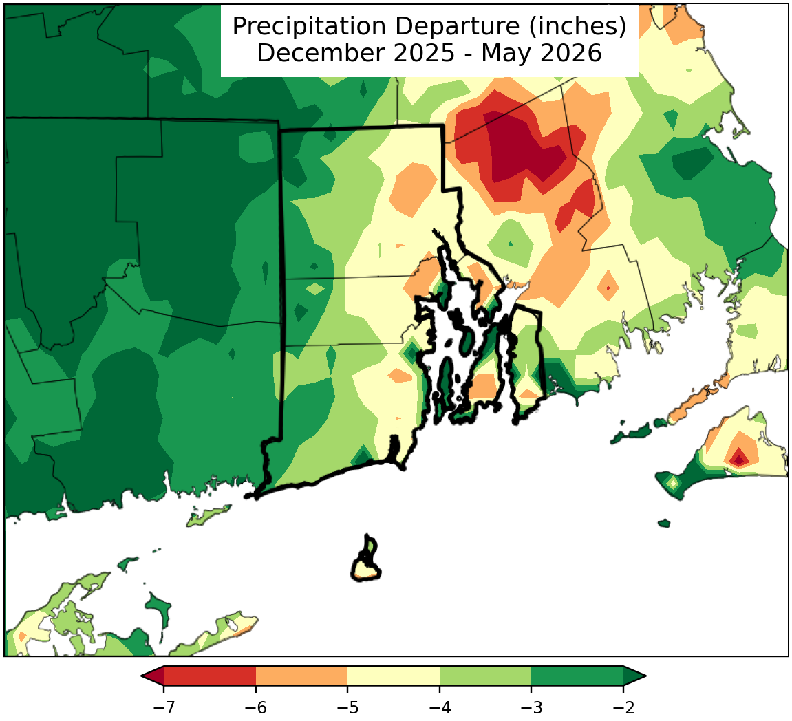
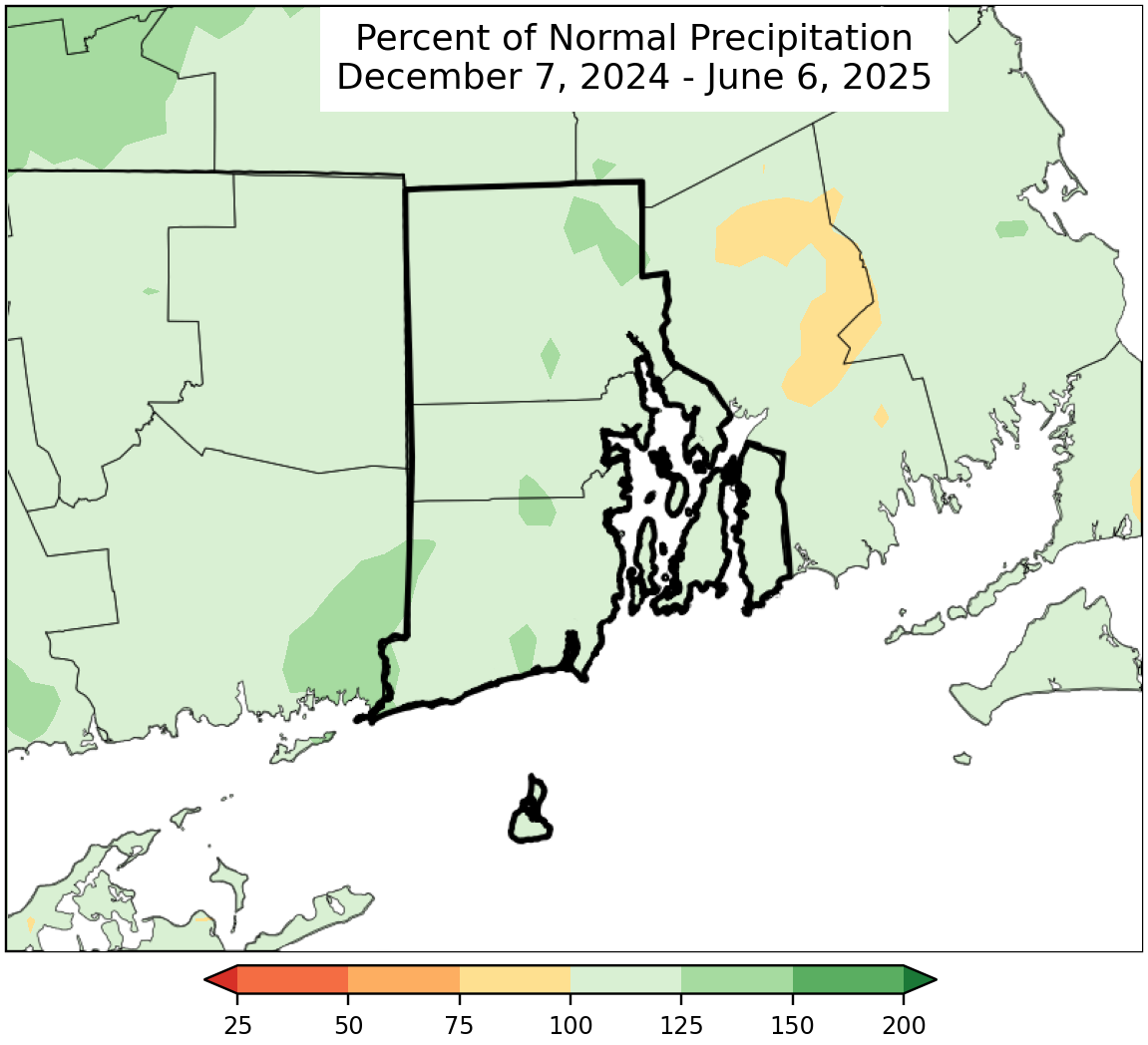
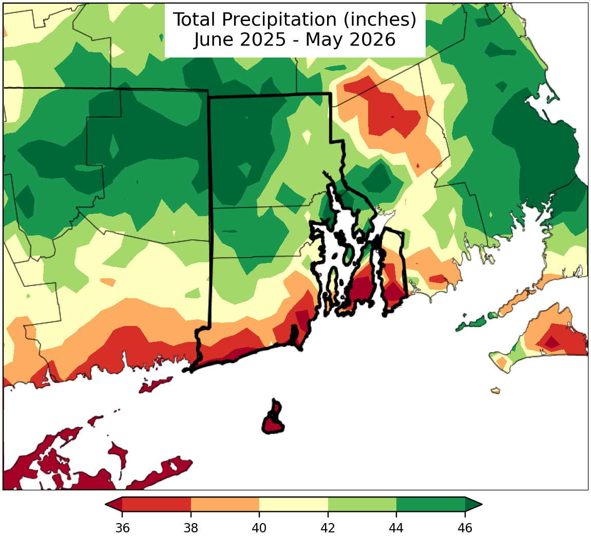
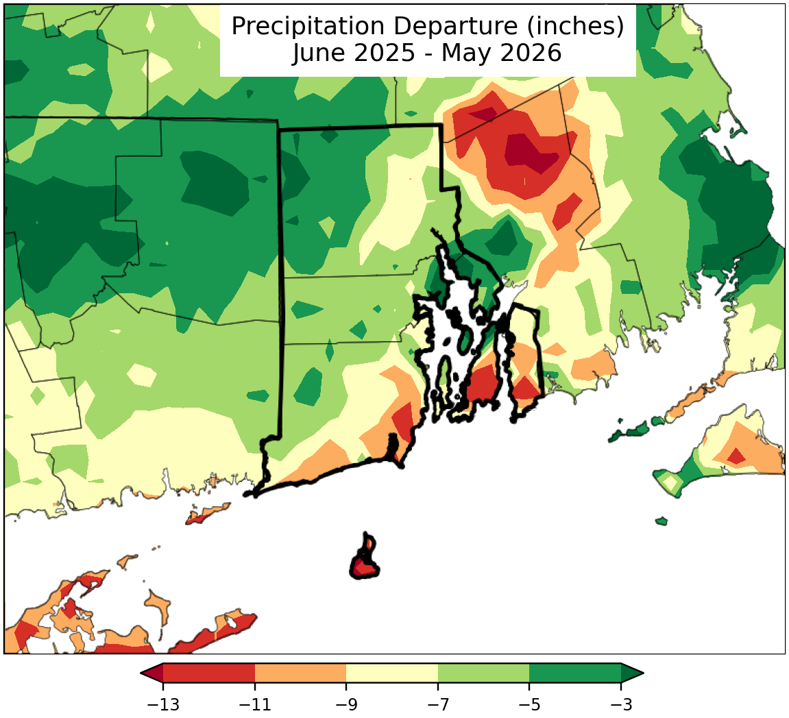
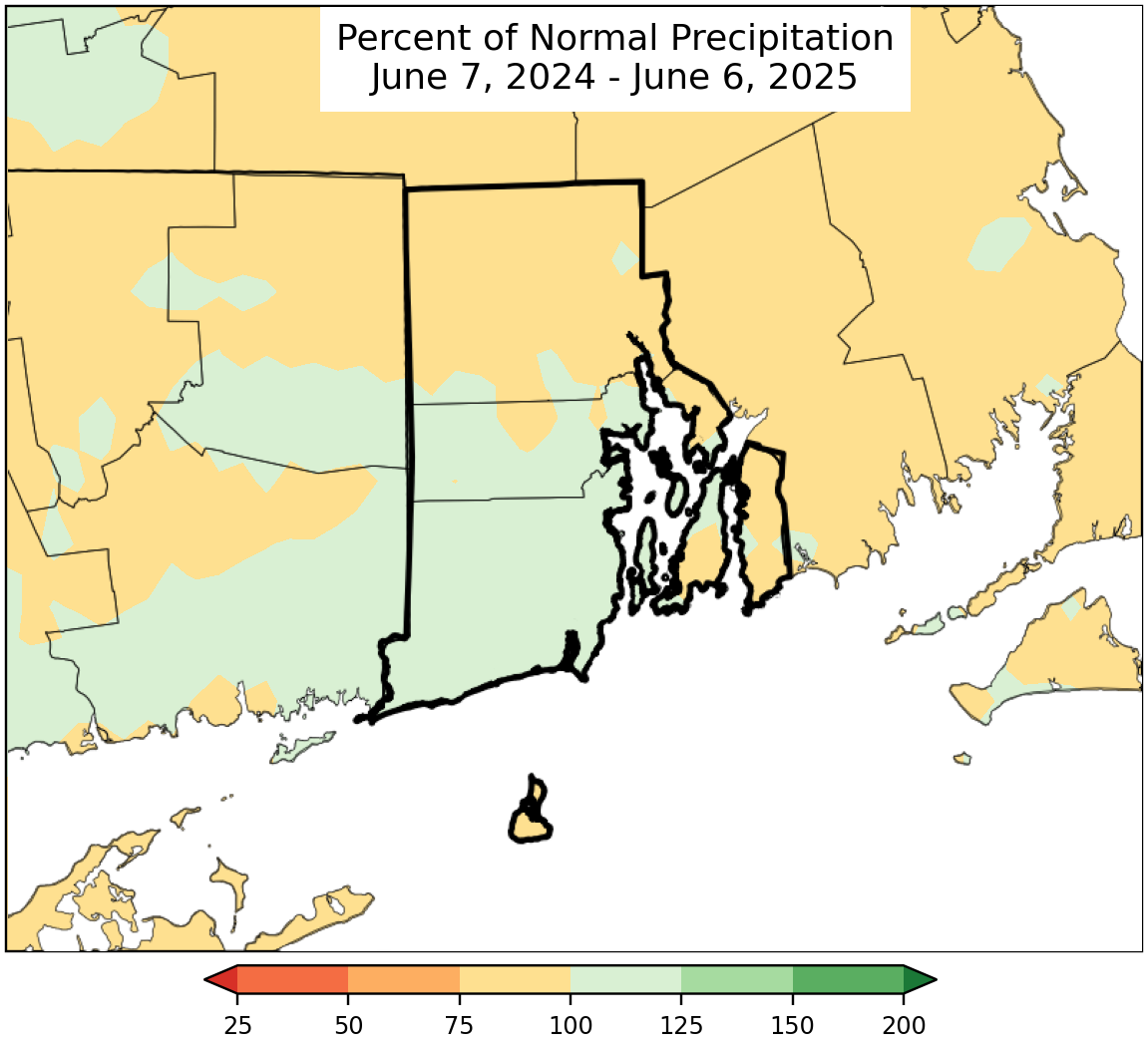
Precipitation Maps
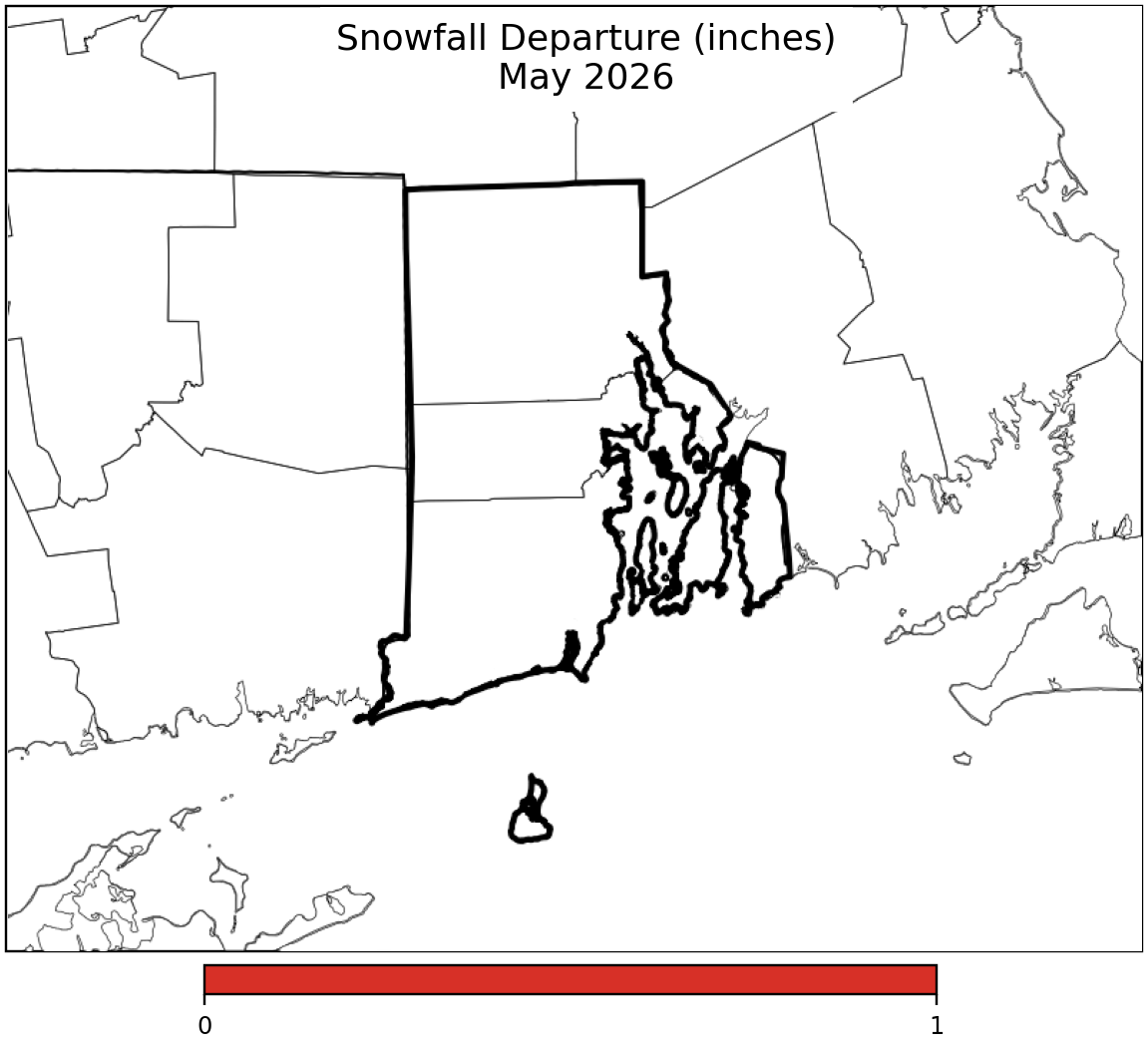
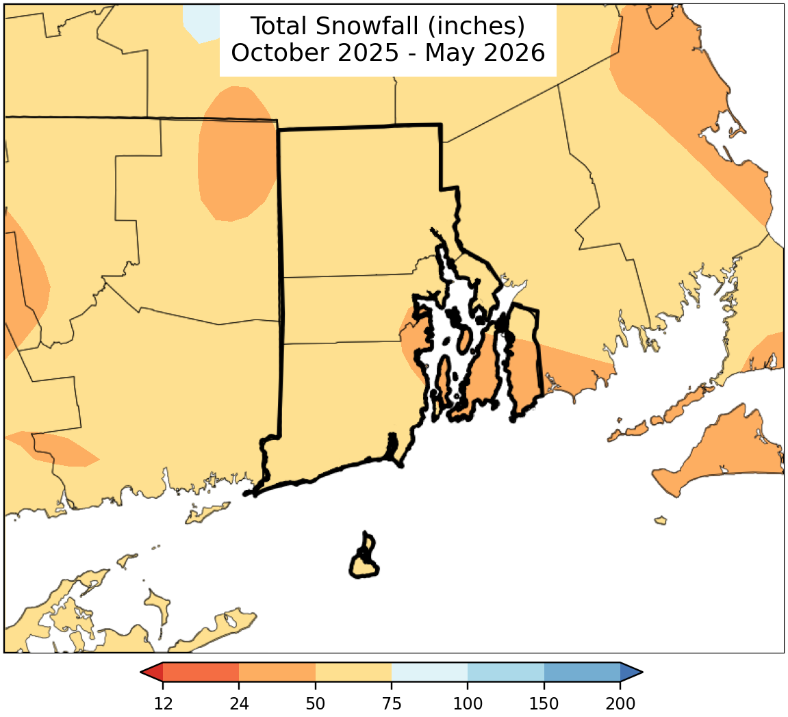
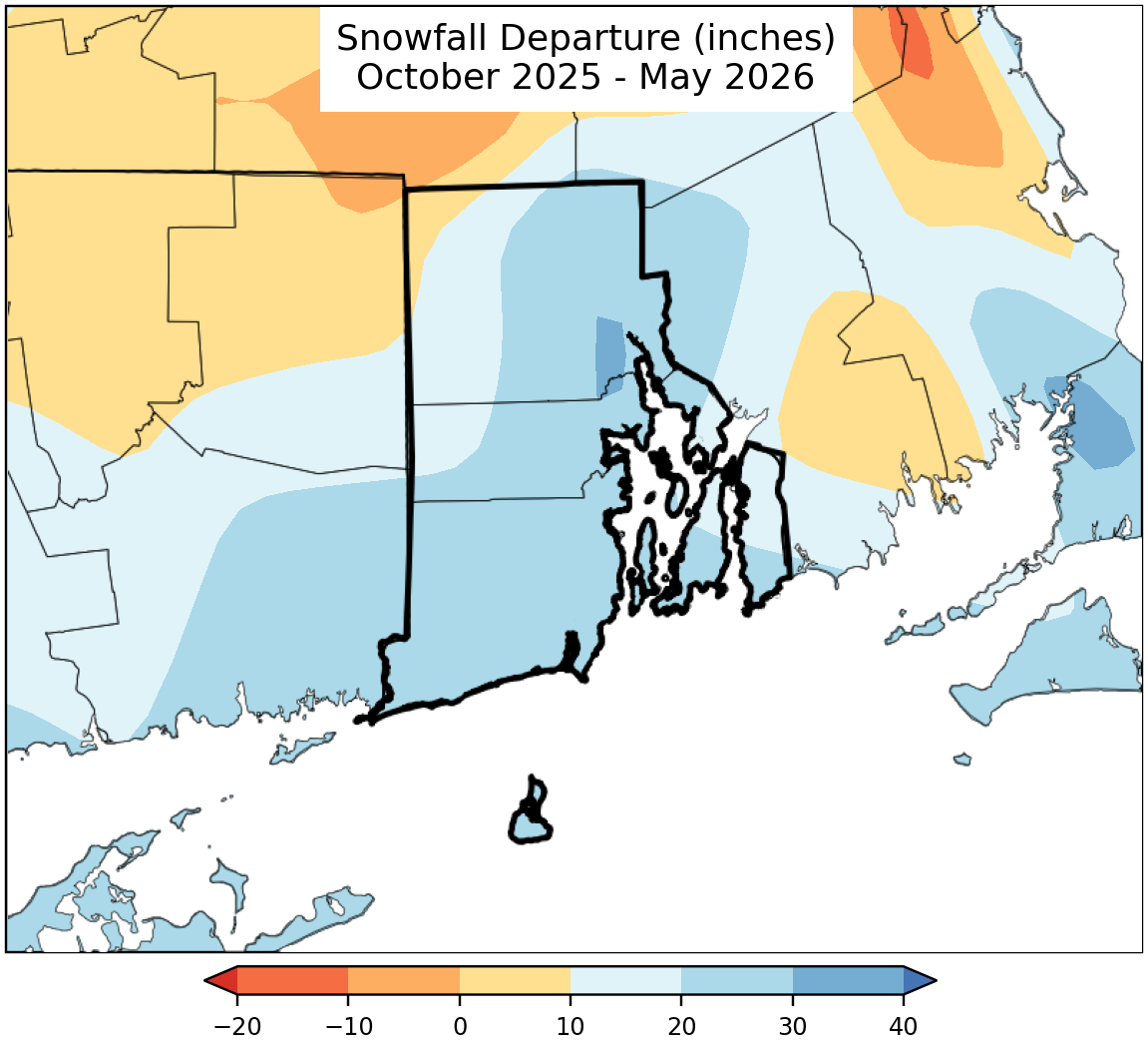
Snowfall Maps
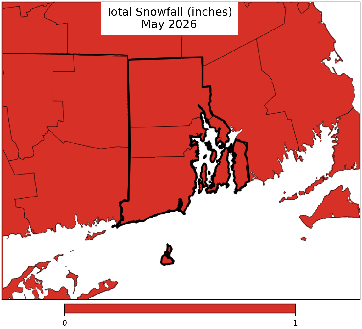
Snowfall maps are only available October through May.
Snowfall maps are only available October through May.
Questions?
If you have questions about climate maps or are looking for other data, please send us an information request.
Troubleshooting
If the above maps do not display up-to-date information, you'll need to clear your web browser's cache.