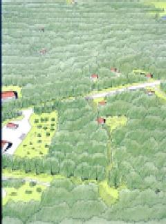
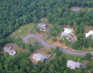
Town Gateway District -- Existing Conditions Before Development
Town Gateway District -- Introduction to the Site
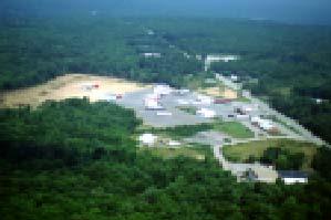
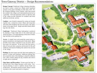
The study area is the part of West Greenwich where Rt 102 meets Interstate 95. Like many such areas it is zoned for a mixture of strip commercial, residential, and industrial uses, each separated into its own zone according to proximity to the highway. The illustration depicts a portion of this area along Rt. 102. Existing development is scattered along the roadside adjacent to the site, including several small commercial and industrial buildings and a large truck stop catering to traffic on the Interstate. The study area was targeted for development in the West Greenwich Comprehensive plan, and there are ongoing efforts to promote economic development in the area, particularly by means of a proposed office park opposite the truck stop.
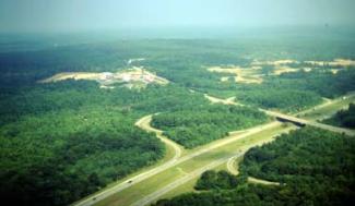
Access to the Interstate makes this site attractive for large-scale development, but as one of the principal gateways to the town, the character of that development is important.

The site illustrated extends across the shoulder of a hill east and west of Rt. 102 beyond the truck stop.
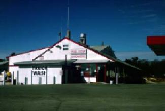
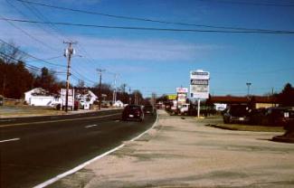
As seen from Rt. 102, the design of the truck stop emphasizes easy access and visibility over landscaping.
If nothing else, the truck stop building is one of the more interesting structures along this stretch of Rt. 102.
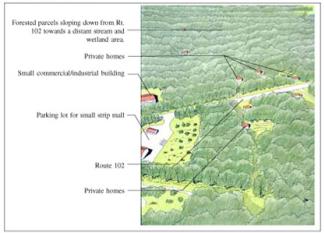
Town Gateway District -- After Conventional Development
Town Gateway District -- Conventional Development
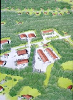
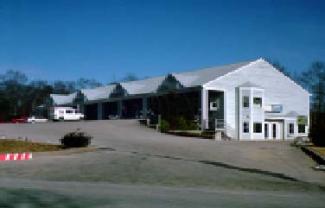
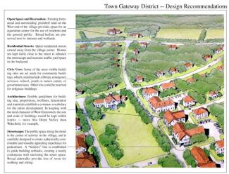
Guided by zoning which calls for a narrow strip of commercial/industrial development along the roadside, with residential districts behind it, development occurs in haphazard fashion as lots become available. With no where else in town to go, a variety of uses find their way here, with small-scale industrial and warehouse uses ending up next to commercial, office and retail structures. The result is a chaotic pattern of development with no focus of activity other than the traffic on the highway. With one or two curb cuts from each lots, drivers must dodge cars pulling in an out from all directions. Eventually the situation becomes so dangerous and dysfunctional that the highway needs to be widened for extra turning lanes.
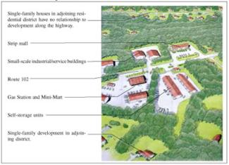
Small-scale industrial development typically occurs lot by lot with little coordination, so is particularly prone to sprawl development pattern.
Lacking other landmarks, strip commercial development depends on signs — the bigger the better — and colorful architecture to attract passing motorists.
Designers of rural commercial buildings often use dormers and gables to make buildings look better, while leaving the barren strip mall parking lot out front.
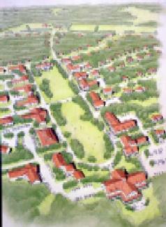
Town Gateway District -- After Creative Development
Town Gateway District -- Implementation Techniques and Examples
Despite being sparsely developed, the study area is cut up by zoning and multiple ownerships into a crazy quilt of lots with varied development potential. The first step is to bring all the landowners and other stakeholders together in a planning process that combines rigorous analysis of the physical capabilities of the land with consensus building as to the advantages of the village development scheme. The next step is to enact a Planned Village Development District to coordinate growth for the entire area (see the Model Ordinances) In this case, such a district could include a very specific plan setting down locations for new roads, building setback lines, location of parks and squares, and other key features. This could be designed to follow existing lot lines, though ideally landowners would agree to combine their lots and create a mechanism for sharing revenues as the village is developed. A major issue on this site is water and sewer service; these, together with road construction, could be developed with municipal bonds or state economic development grants. Like the more familiar industrial park projects, this effort is an ideal use of such targeted infrastructure investments, and certainly a well-designed and coordinated plan is more likely to win state or federal grant money — especially one with a sustainable development theme.
The project could prove problematic if it engenders so much development in this end of West Greenwich as to create the kind of suburban sprawl it is designed to prevent. It is thus very important to set firm growth boundaries for the village at the beginning of the project, beyond which a permanent greenbelt is maintained. This process could be enhanced by the use of a Transfer of Development Rights Ordinance, which would allow more units to be built within the boundaries of the village in exchange for protecting open space in the surrounding countryside. A Note of Thanks and Credit: The creative proposal is based on previous concepts developed by Richard Youngken of The Newport Collaborative and Joe Lombardo as part of an earlier study for the Town of West Greenwich.
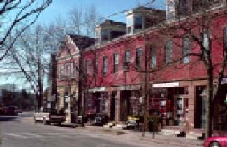
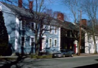
Main Street in Wickford illustrates the success of a pedestrian-friendly design concept that has worked well for hundreds of years: the commercial block with shops on the ground floor and offices and apartments above. Broad sidewalks sheltered from the wind by the continuous mass of the building make for a comfortable stroll throughout the year.

Quiet residential streets lead away from the center of Wickford. Uses change, but the basic form of the street remains, with buildings quite close together and right on the sidewalk. The result is a pleasant enclosure of the street.