Growing Commercial Corridor -- Existing Conditions Before Development
Growing Commercial Corridor -- Introduction to the Site
The study area is comprised of the district bisected by Rt. 138 in Richmond, extending from I-95 to the town government buildings at Carolina -Nooseneck Rd. (Rt. 112). Sparsely developed along the road frontage, this corridor has been developing as an ad hoc commercial strip, despite efforts by local planners to encourage coordinated planning. Zoned as a planned development district, most residential and business uses are allowed with site plan review. This has led to better design of development on individual parcels, but multiple ownership of the road frontage means that there has been little coordinated development. Larger parcels behind the road frontage, meanwhile, have been waiting for the market to support the investment in access roads and site preparation that would be required for their development.
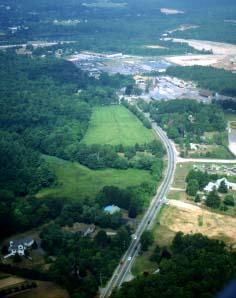
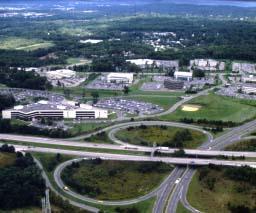
Commercial development extends down Rt. 138 from Exit 3 on I-95, in the distance. Development has been haphazard up until now, with a mix of uncoordinated uses.

Many parcels along the Rt. 138 frontage are in a state of transition from older resource-based activities like gravel mining to an uncertain future.
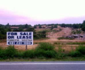
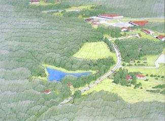
Just beyond the road frontage to the North and South of the parcel, thousands of acres of developable land, like this gravel pit, promise big changes to this district in the near future.
Growing Commercial Corridor -- After Conventional Development
Growing Commercial Corridor -- Conventional Development
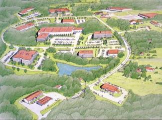
Without a masterplan for the entire district, development continues on a parcel-by-parcel basis. Larger lots offer a chance for more coordinated development, but as with residential subdivisions, the commercial review process is geared more toward building safe roads and parking lots than to building a real community. Market forces conspire against better planning as well, since developers are loath to place any restrictions or guidelines on potential lot buyers, and construct speculative office buildings to appeal to the lowest common denominator. What results is a development without a center, with little relationship to its context or contribution to the visual character or quality of life in the community.
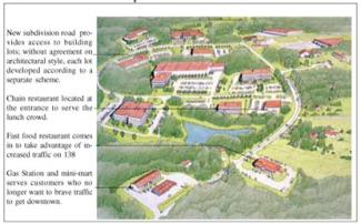
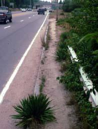
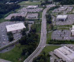
Deteriorating roadside with what passes for a sidewalk is symptomatic of commercial strip development, where most of the investment goes into individual parking lots and buildings, and the public street is left to fend for itself.
Most towns would be glad to have the taxes from an office park like this one, but there are consequences. Traffic increases dramatically, since everyone who works here needs a car just to get lunch. Visually and functionally, this approach to development has nothing to do with a historic rural landscape, and is so generic in style that it could be almost anywhere.
Growing Commercial Corridor -- After Creative Development
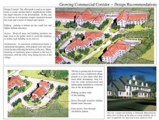
Growing Commercial Corridor -- Implementation Techniques and Examples
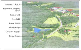
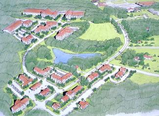
Despite current zoning as a planned development district, the Rt. 138 corridor is developing haphazardly with a mix of commercial, retail and residential uses, all spread out along the roadside. The process of implementing a more creative development scenario begins with preparation of a comprehensive corridor plan that set down in detail proposed uses, location of roads, and protected open space for all parcels along the highway and, especially, those behind it. This will require landowners to come to grips with an uncertain future, and town officials and neighbors to realize the scale of development that is possible. It will also mean making decisions about how much development, and what kind, is appropriate for an area like this.
At some point decisions will have to be made about where the focus of this new neighborhood should be. Is it the Richmond Town Hall area? Should it be kept close to the Exit 3 interchange? Or should the district be composed of a number of small neighborhood centers linked together by 138 like a string of pearls? Even on the most conceptual level, this overall plan would go far in guiding growth more effectively.
Once some consensus is reached _ and that's the hard part _ a Planned Commercial Development District is enacted to guide planning, design, and construction. This must go further than the current planned development district, especially in regard to establishing a neighborhood structure to tie each parcel together into an integrated whole. While the current district is valuable insofar as it provides for better design on each parcel, it says little about what the physical structure of the area should be _ where are its centers, it's circulatory spines, and its outer edges? If these planning and design decisions can be made then every development, whether of a large tract of land or small frontage parcel, serves to advance the development of a real community.
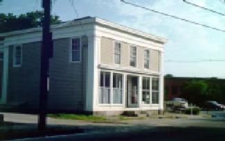
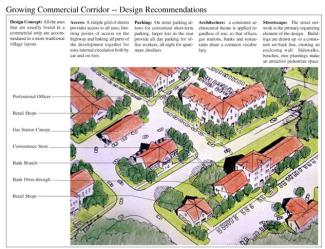
This simple mixed-use building in Wakefield is a wonderful example of the kind of structure that used to be built on 19th century streets. Like many modern commercial buildings, it is little more than a box, but a little extra attention has been given to the front facade. This creates an attractive entrance for the building, but just as importantly adds to the visual character of the shared public street.
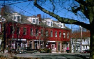
As we have seen, good architecture on a bad site plan makes for a bad result. Successful places succeed, not just on the basis of architectural style, but because the buildings, like this block in Wickford create a comfortable, human scaled environment both inside and out.
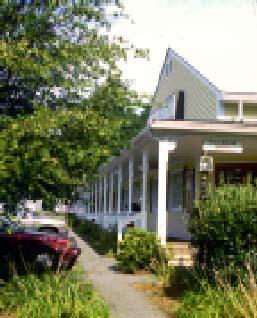
Even strip malls can be made better, not just by putting a peaked roof on the building, but by providing comfortable places to walk, covered porches, and lush landscaping.
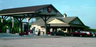
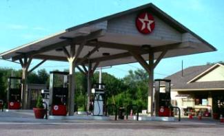
This Texaco Station on Rt. 1 in Charlestown displays a different take on the typical pump canopy. Wood columns and peaked roof match the lines of the adjoining building and fit the character of South County more than most.